What Does This Mean for You?
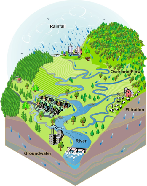
As a part of the Flint River watershed, anything you do can flow downstream and potentially harm your neighbors. We are all connected by the water that flows past us over our yards and streets and into the storm drains and roadside ditches. What you do at your home, in your car, at your place of school or work, and at the places you play all can have an important effect on the Flint River.
Dive Deeper into our Flint River Watershed
The Flint River watershed is more than 1,358 square miles and encompasses portions of 7 counties, 20 cities & villages, and 58 townships. The watershed drains this large land area through the Flint River and all the tributaries of the river. It includes most of Genesee and Lapeer Counties, and parts of Shiawassee, Oakland, Tuscola, Sanilac, and Saginaw Counties.
The Flint River is 142 miles long and is formed in Lapeer County near Columbiaville where the river’s South Branch and North Branch come together. The river is supplemented by four major creeks:
- Kearsley (draining the south and central portions of the east side of Genesee County)
- Thread (draining the south central part of the county)
- Swartz (draining the Swartz Creek area)
- Misteguay (draining the area near the northern section of the border of Genesee and Shiawassee counties)
The Flint River empties into the Shiawassee River in the Shiawassee National Wildlife Refuge near the city of Saginaw. Within the refuge, the Cass and Tittabawassee rivers combine with the Shiawassee to form the Saginaw River, which then empties into the Saginaw Bay of Lake Huron. The Flint River watershed is a subwatershed of the Saginaw Bay watershed.