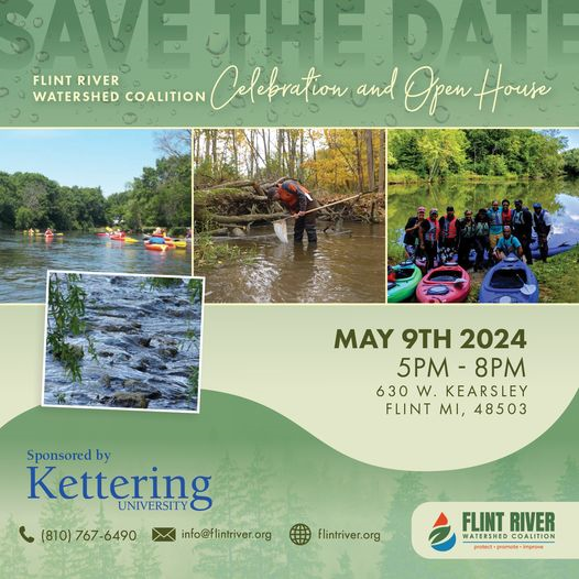
Partnering to protect, promote, and improve our watershed
New Paragraph
The Flint River Watershed Coalition is a membership organization that promotes citizen stewardship of our natural resources by providing our members with the sources, knowledge, and capacity necessary to protect local water quality and watershed habitat.
Thank you for supporting our Flint River watershed!
Flint River Watershed Coalition
Please see below for updates on the chemical spill near the Utah Dam on 6/29/23
Get Outside
The Flint River is a place where you can enjoy many outdoor activities including paddling, fishing, biking and walking.
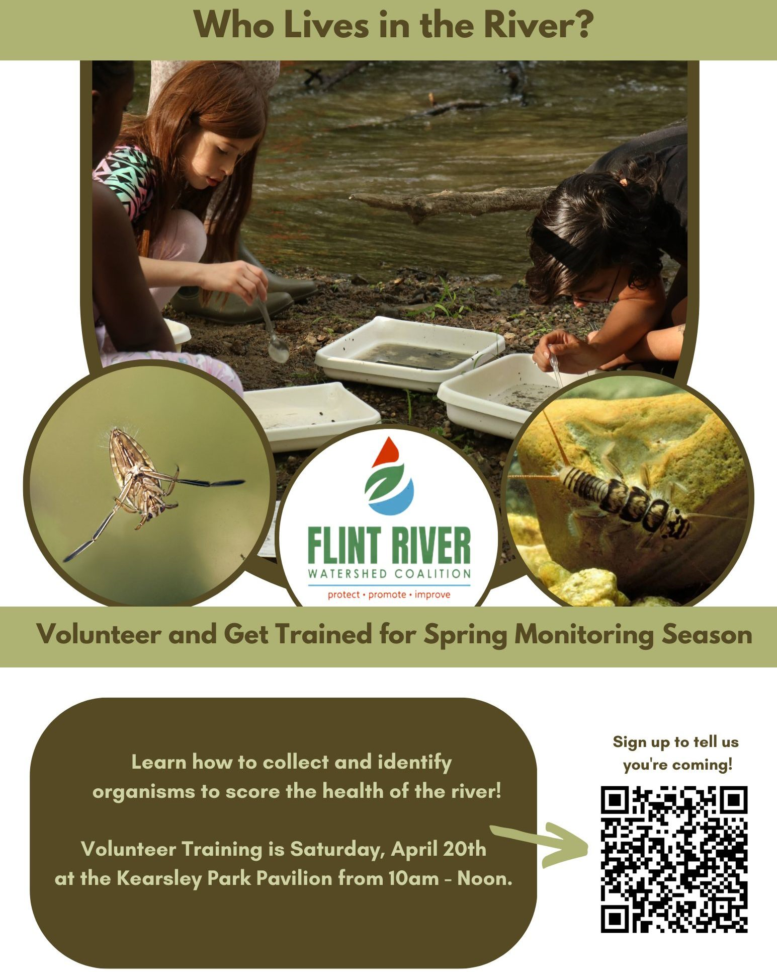
Learn
Learn about the Flint River watershed, what it means to our local environment, and what is endangering the river.
Protect
It is important to understand how the Flint River watershed works and understand what you can do to help protect it.
Our Work
FRWC Programs provide a safe and enjoyable way to get out, get wet and learn about this amazing resource.
Donate
Our services and programs are largely funded by grants and donations from our supportive community.
Get Involved
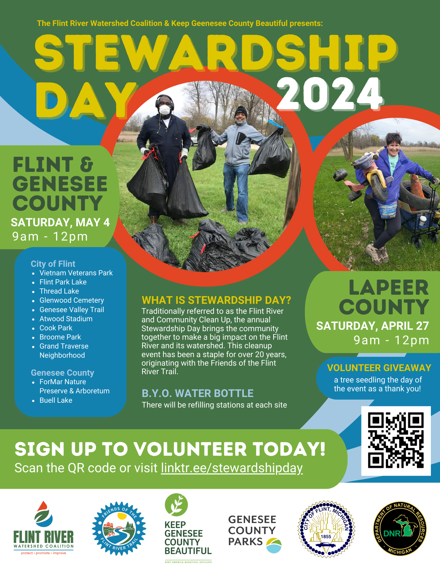
Get your feet wet! We are always looking for volunteers to help us fulfill our mission. Helping out is rewarding and fun!
Fun Facts About the Flint River and its watershed:
1,358
Watershed in Square Miles
142
River's Length in Miles
7
Counties Spanned
The Native American name for the Flint River is Pewonigowink, meaning “River of Fire Stone”.
The Flint River watershed lies within the ancestral, traditional and contemporary lands of the Anishinaabeg – Three Fires Confederacy of Ojibwe, Odawa, and Bode Wad Mi peoples. FRWC offices exist on the traditional territory and homelands of the Anishinaabeg. This land was ceded in the 1807 Treaty of Detroit during forced and systematic removal of Indigenous peoples. FRWC affirms Indigenous sovereignty and commits to ongoing protection of the cultural and natural histories of these homelands.
“When I worked for the Watershed Coalition and Kayak Flint, I felt not only am I helping my city, but I’m also having fun doing it at the same time.”
Marcell, Kayak Flint staff
“Students look forward to completing this unit (Flint River GREEN Bridges) every year. They love the opportunities they get to go outside and complete activities that actual scientists do.”
Ashley Booker
8th Grade Teacher, Atherton Jr. High
“Really nice people who seem to put safety and community first…Helped change my opinion about the Flint River and Flint itself. The community could use more folks like this advocating!!”